Sea rise report shows devastating impact on Scotland
A new scientific report has revealed vital parts of Scotland could be flooded by rising sea levels within just 30 years.
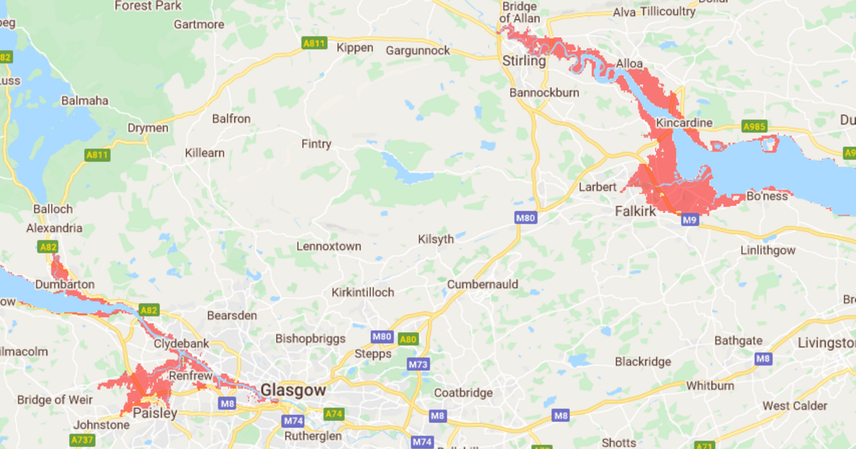
The global report from Climate Central uses new methodology to reveal coastal flood threats around the world, revealing the global vulnerability to sea level rise is far worse than previously thought.
An interactive map shows the impact of the unchecked climate emergency on Scotland, including flooding towns like Clydebank and Dumbarton, large parts of Falkirk, Perth and Stirling and areas such as Leith in Edinburgh.
The Scottish Greens have highlighted the report’s findings during an election campaign which has largely ignored the crisis.
Commenting, Scottish Green environment spokesperson Mark Ruskell said: “Rising sea levels have long been associated with global warming, but this report reveals the impact of the climate emergency in the next 30 years.
“This election has seen the parties pay lip service to this crisis, but when will they actually stop supporting aviation expansion? When Glasgow airport is under water? Will they finally stop subsidising oil and gas only after Grangemouth has been claimed by the Forth?
“Locals on the island of Vatersay old me over a decade ago that they were concerned that the island would be split in three, and here those worries are confirmed.
“Although the impact on Scotland is worrying enough, this interactive map shows just how devastating this rise would have on coastal Asia and other parts of the world. That displaces whole communities, creates poverty and geopolitical tension.
“It’s long past time we took this threat seriously and acted with the urgency required. The clearest way to demand climate action is to vote Green on Thursday.”